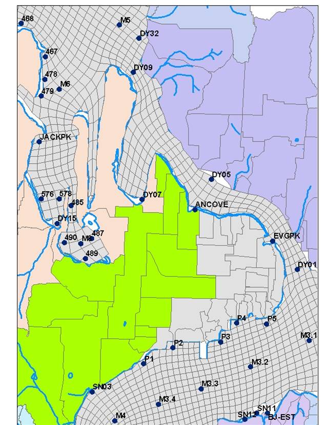
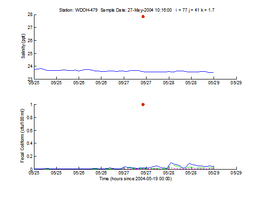
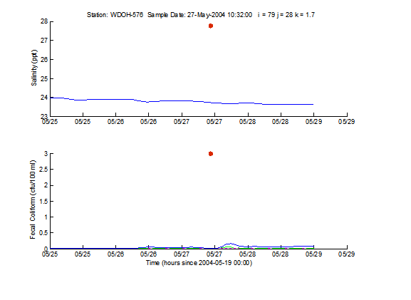
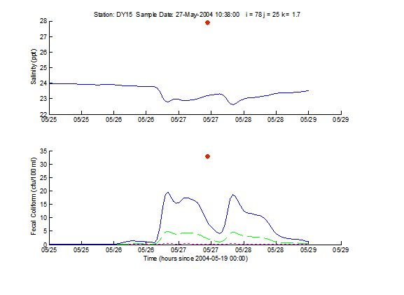
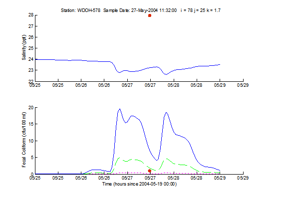
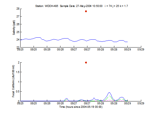
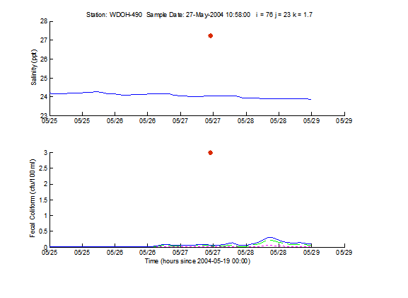
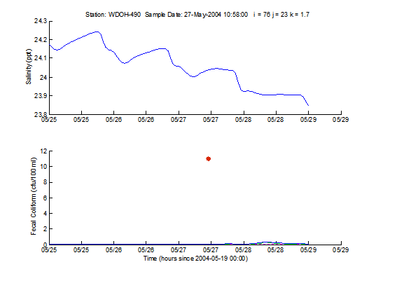
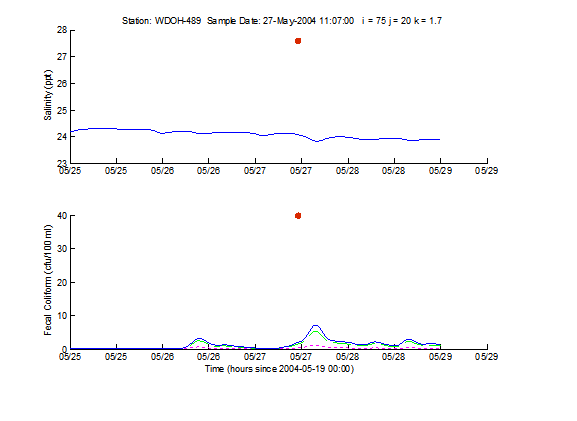
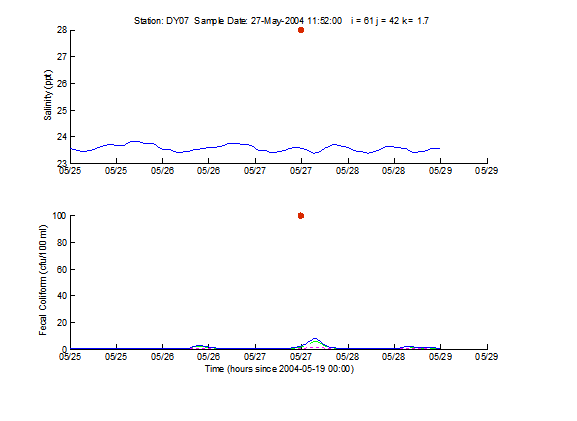
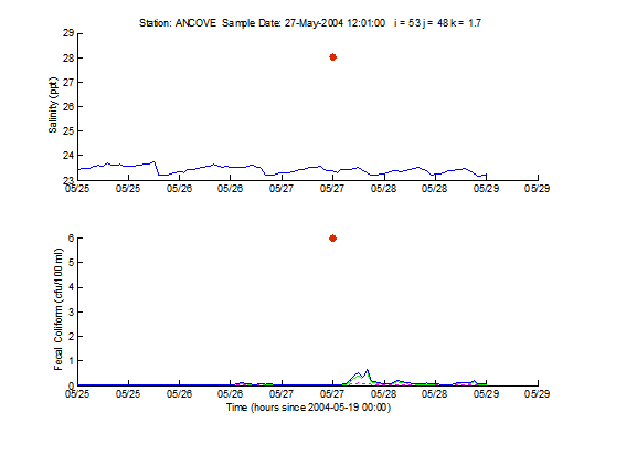
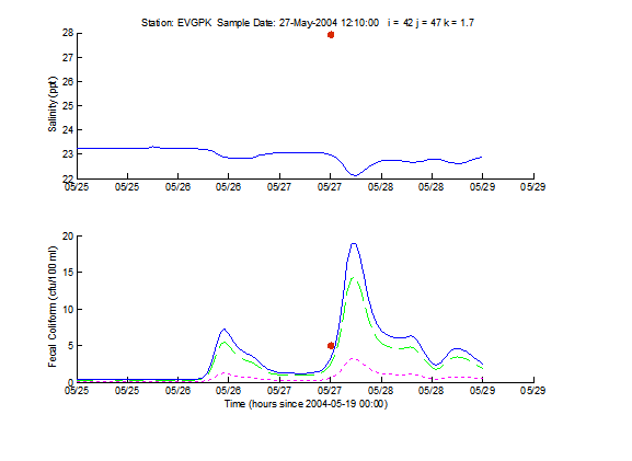
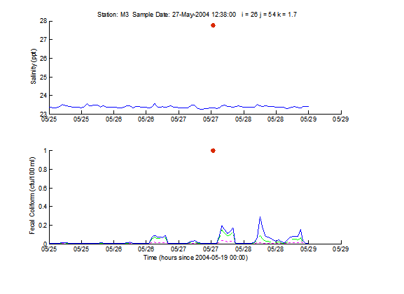
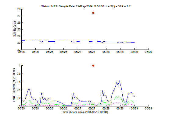
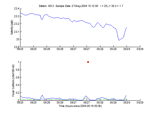
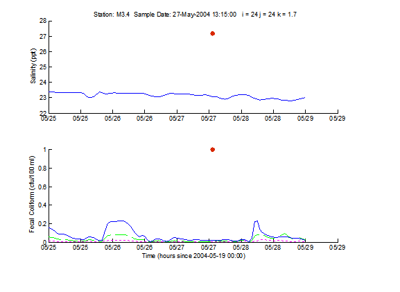
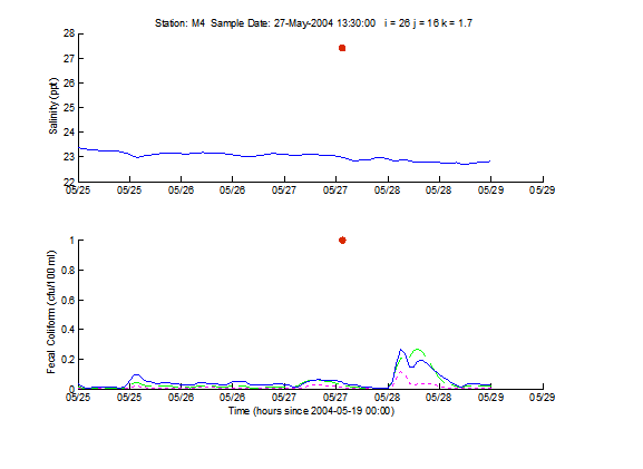
Verification Results for Simulated and Observed FC and Salinity Data for May 2004 Storm Event Using 91x96 Grid (Bremerton)

Data Summary for Sampling Results

Map of Stations Sampled for May 2004 Event

Results


Results

DY01 Mouth of Port Washington Narrows

DY05 Port Washington Narrows (East Bremerton, Lions Park)

DY09 Port Washington Narrows Rocky Point

DY09DUP Port Washington Narrows Rocky Point


WDOH-467 Ostrich Bay Erlands Point (North)

WDOH-478 Ostrich Bay Erlands Point (Middle)

M6 Ostrich Bay (Center of)

M6Dup Ostrich Bay (Center of)

WDOH-478 Ostrich Bay Erlands Point (South)

JACKPK Ostrich Bay Jackson Park Outfall

WDOH-576 Ostrich Bay ( Shorewood Dr)

DY15 Ostrich Bay - Mouth of Ostrich Bay Creek

WDOH-578 Ostrich Bay Madrona Point

WDOH-485 Oyster Bay Madrona Point

WDOH-490 Oyster Bay South of Madrona Point

WDOH-490Dup Oyster Bay South of Madrona Point

WDOH-489 Oyster Bay Lower Oyster Bay Dr.

M8 Oyster Bay (Center of)

WDOH-487 Oyster Bay Marine Drive

DY07 Head of Phinney Bay

ANCOVE Port Washington Narrows Anderson Cove

EVGPK Port Washington Narrows Evergreen Park

M3 Mouth of Sinclair Inlet

M3.2 Sinclair Inlet middle of Inlet between Shipyard and Port Orchard

M3.3 Sinclair Inlet middle of Inlet off Dry Dock 6

M3.4 Sinclair Inlet middle of Inlet offshore of reserve basin

M4 Sinclair Inlet middle of Inlet offshore of Ross Point

SN03 Sinclair Inlet near Bremerton WWTP outfall

P1 Sinclair Inlet PSNS (Callow Ave)

P2 Sinclair Inlet PSNS Naval Station (PSNS015)

P3 Sinclair Inlet PSNS CIA West

P4 Sinclair Inlet PSNS CIA middle

P5 Sinclair Inlet PSNS CIA east (ferry terminal)

Return to 2004 Storms Simulation Results Page


This US Government system is subject to monitoring. Please read the Privacy Policy.